Approaches to New York Harbor
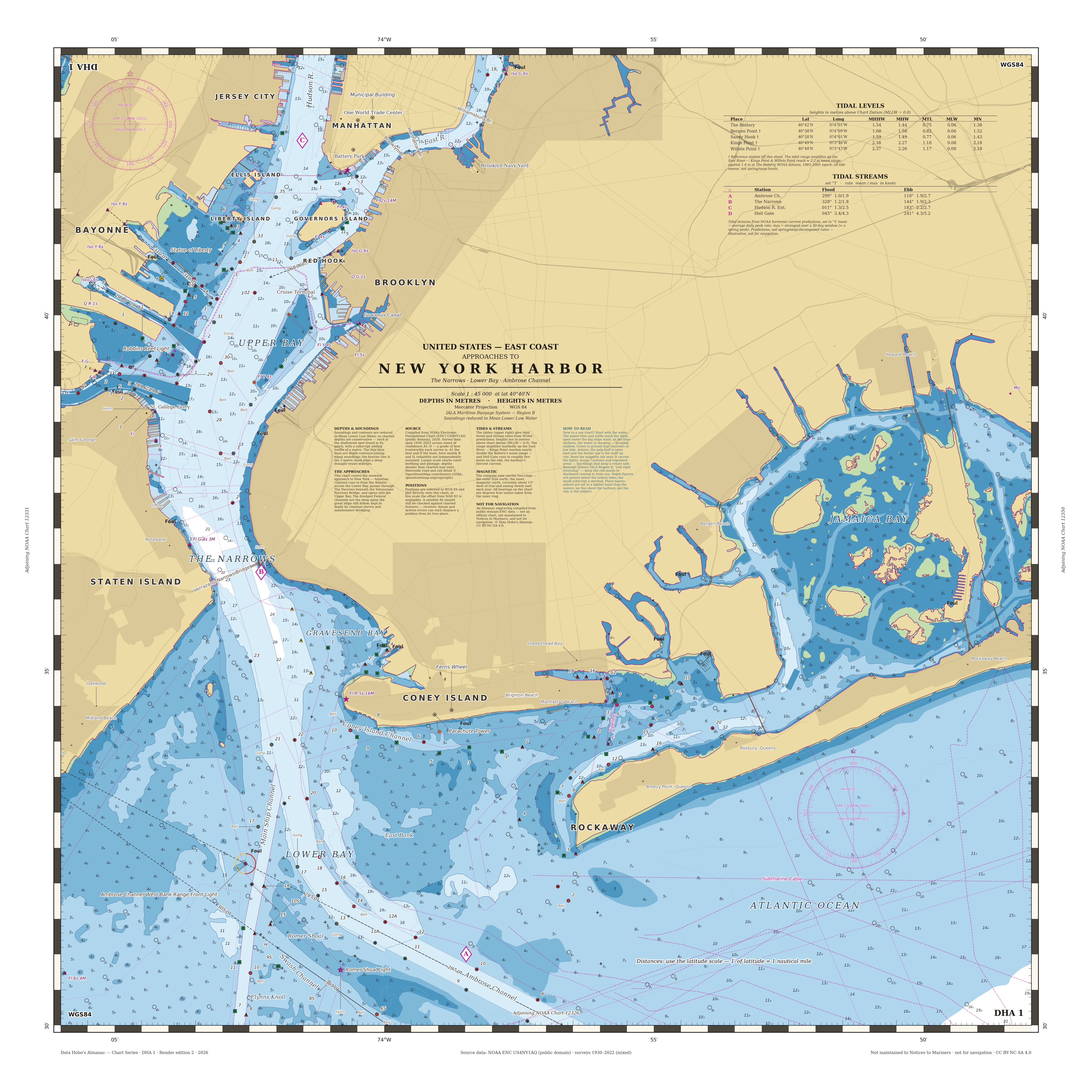
A nautical chart of the approaches to New York Harbor, drawn in the style of a modern electronic navigational chart. It covers the seaward gateway to the port — the Lower Bay, the Narrows between Staten Island and Brooklyn, and the Anchorage Channel that carries traffic up toward the Hudson and East Rivers. Soundings and depth contours are given in metres, and the familiar bands of blue step from the shoals and flats out to the deeper water of the dredged channels.
It is rendered from NOAA’s public-domain Electronic Navigational Chart for the harbor — cell US4NY1AQ — compiled from hydrographic surveys spanning 1930 to 2022. The shoreside road and rail detail is drawn from OpenStreetMap. The symbology follows the international S-52 convention used on shipboard chart displays, and the margins carry the usual furniture of a paper chart: a compass rose, tidal-level and tidal-stream tables, and the datum note (WGS 84). It is a faithful reproduction of the cartographic form, not a working document — it is not maintained to Notices to Mariners, and it is not for navigation.